Header Graphic

Browse by map

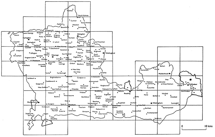
This page shows a map of Berkshire divided into boxes. Click on a box to see an Ordnance Survey map of the area for the 1880s. Each of these maps has been coloured to show the relevant enclosure map available on this website. Click on a coloured area to find the map, and see images of it. Please note that the Ordnance Survey maps have not been coloured for areas where only an award exists for the enclosure. Please use the place name search to find awards.


You are viewing the OS Grid

OS GRID Area includes; N/A : Click to zoom in Area includes; N/A : Click to zoom in Area includes; N/A : Click to zoom in Area includes; N/A : Click to zoom in Area includes; N/A : Click to zoom in Area includes; N/A : Click to zoom in Area includes; N/A : Click to zoom in Area includes; Remenham, Hurley: Click to zoom in Area includes; N/A : Click to zoom in Area includes; Easthampstead: Click to zoom in Area includes; Barkham, Finchampstead, Sandhurst: Click to zoom in Area includes; Stratfield Mortimer, Swallowfield: Click to zoom in Area includes; Padworth, Wasing, Aldermaston: Click to zoom in Area includes; Shalbourne, Inkpen: Click to zoom in Area includes; Kintbury, Hamstead Marshall, Enborne, West Woodhay: Click to zoom in Area includes; Newbury, Greenham, Thatcham, Brimpton, : Click to zoom in Area includes; Frilsham, Bucklebury : Click to zoom in Area includes; Welford, Boxford, Winterbourne, Avington, Speen: Click to zoom in Area includes; Hungerford: Click to zoom in Area includes; Bradfield, Englefield, Stanford Dingley, Theale, Sulhamstead Bannister, Beenham, Woolhampton: Click to zoom in Area includes; Reading, Tilehurst, Burghfield, Shinfield, Earley: Click to zoom in Area includes; Wokingham, Hurst: Click to zoom in Area includes; Warfield, Winkfield, Sunninghill, Binfield: Click to zoom in Area includes; Old Windsor: Click to zoom in Area includes; Windsor, Clewer : Click to zoom in Area includes; White Waltham, Bray : Click to zoom in Area includes; Wargrave, Waltham St. Lawrence, Ruscombe: Click to zoom in Area includes; Purley: Click to zoom in Area includes; Aldworth, Basildon, Ashampstead, Pangbourne, Tidmarsh, Yattendon: Click to zoom in Area includes; Lambourn, East Garston: Click to zoom in Area includes; Chaddleworth, Brightwalton, Leckhampstead, East Shefford: Click to zoom in Area includes; Beedon, Compton, Hampstead Norreys: Click to zoom in Area includes; Fawley, Farnborough, Catmore: Click to zoom in Area includes; N/A : Click to zoom in Area includes; Ashbury: Click to zoom in Area includes; West Ilsley, East Ilsley, Blewbury: Click to zoom in Area includes; Aston Tirrold, Moulsford, Streatley: Click to zoom in Area includes; Wallingford, Brightwell, Sotwell, Cholsey, South Moreton: Click to zoom in Area includes; Didcot, Harwell, West Hagbourne, East Hagbourne, Upton: Click to zoom in Area includes; Longcot, Shrivenham: Click to zoom in Area includes; Little Wittenham: Click to zoom in Area includes; Abingdon, Marcham, Drayton, Appleford, Sutton Courtenay, Long Wittenham: Click to zoom in Area includes; Baulking, Uffington, Sparsholt, Kingston Lisle, Goosey, Woolstone, Childrey: Click to zoom in Area includes; Hinton Waldrist, Kingston Bagpuize, Fyfield, Frilford, Garford, Lyford: Click to zoom in Area includes; Faringdon, Shellingford, Pusey, Buckland, Hatford, Little Coxwell, Stanford in the Vale: Click to zoom in Area includes; Buscot, Coleshill, Great Coxwell, Eaton Hastings: Click to zoom in Area includes; Cumnor, Wootton, Sunningwell, South Hinksey, Radley: Click to zoom in Area includes; Appleton, Besselsleigh: Click to zoom in Area includes; N/A : Click to zoom in Area includes; Wytham: Click to zoom in Area includes; N/A : Click to zoom in Area includes; Maidenhead, Bisham: Click to zoom in Area includes; Wantage, Denchworth, Steventon, Ardington, East Challow: Click to zoom in


This page was printed from the BRO New Landscapes website on 3/19/2024.